3DISCOVER / PRACTICAL GUIDE
Tactile map for a museum: preparing the design brief
From orientation to audio interpretation: questions and source materials to prepare when commissioning a tactile map for your museum.
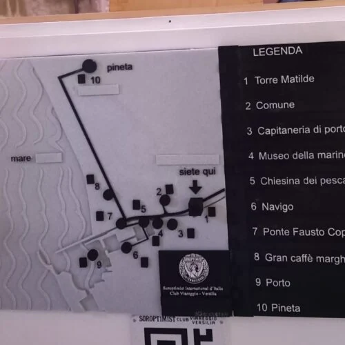
To design a tactile map for a museum, first decide what it should help a visitor understand: their location, the route to a gallery or the layout of a building. That purpose determines which information belongs on the map, how relief features and the legend work, and whether audio is useful. Simply printing a floor plan in 3D does not answer all of these questions.
This guide helps museum teams, curators and designers prepare a practical brief. 3discover’s tactile projects include maps, Braille, three-dimensional models and audio descriptions. The combination should reflect the space and the people who will visit it.
Finding your way and exploring an object are different tasks
An orientation map explains relationships between places: entrances, galleries, facilities and landmarks. A tactile model lets visitors explore a form, such as the façade of a monument or the volume of a sculpture. They can work together, but one object does not need to communicate every detail of the museum.
For instance, a hypothetical display about a historic building could use a map to show its location and a separate model to explain its volume. This is a possible approach to discuss during design, rather than a solution that suits every exhibition.
Select the information before designing the relief
The brief should identify a visitor’s main question: “Where am I?” or “What makes up this place?”. An existing floor plan is a starting source. Turning it into a tactile resource requires decisions about what is essential.
- Recognisable landmarks: choose features that connect the map with the actual space.
- Routes: distinguish the routes being explained from background details.
- Symbols and legend: give relief features consistent meanings and check whether they can be recognised.
- Text: use clear, concise names instead of placing every museum label on the surface.
Selecting fewer details does not have to reduce the visitor’s understanding. It allows information to be distributed across the map, the model and the narrative in a clear sequence.
Braille and audio: give each format a clear role
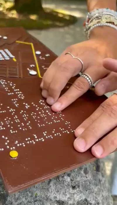
Braille labels can identify features and reference points; a tactile legend explains the symbol system. Audio can add context, describe relationships and accompany exploration. A QR code is one possible link to an audio description, but the visitor also needs a practical way to locate and use it.
The tactile surface should offer useful information before a digital resource is opened. Specify what stays on the map, who prepares and checks Braille transcriptions, which languages the audio will use and who will maintain the links over time.
The Museo Tattile Statale Omero lists Braille, relief reproductions and text review among its resources for blind and partially sighted visitors. It provides a useful reference for considering objects and interpretation together, without expecting one technology to deliver every aspect of an accessible visit.
Location, materials and everyday use
Assess the map in the place where it will be used. Bring photographs and measurements of the space, the proposed location, lighting conditions and information about how visitors can approach and explore it. Include people visiting while seated and people using mobility aids in that assessment.
Materials, finish and support depend on indoor or outdoor use, how frequently the map will be touched and its maintenance needs. Ask how cleaning, wear and replacement parts will be handled. Do not choose a material solely because of its appearance in a photograph. The exhibition’s responsible team and appointed professionals should assess safety requirements and any applicable specifications.
A practical brief for your project enquiry
- Purpose: orientation, understanding a building or exploring an artwork.
- Setting: museum, temporary exhibition or outdoor route; proposed position and installation constraints.
- Available material: current floor plans, photographs, drawings and interpretation texts.
- Visitors: needs to consider and people or organisations who can take part in the review.
- Content: features, legend, Braille, languages and desired audio.
- Management: project contact, maintenance, available budget and exhibition schedule.
Before approving production, agree how the prototype and its information will be reviewed. Involving blind and partially sighted people and relevant specialists can provide feedback about recognisability, reading order and use in the actual setting. Checking a digital model on a screen cannot replace tactile exploration.
Frequently asked questions
Is a tactile map always a copy of the floor plan?
No. A floor plan describes a space; tactile design selects and organises information for a specific purpose. The level of detail should be checked during the design process.
Can a tactile map and a 3D model be used together?
Yes, when they perform complementary tasks. The map can explain spatial relationships while the model communicates the shape of a building or artwork. 3discover produces both as part of its cultural accessibility work.
How much does a museum tactile map cost?
A quotation is prepared for the specific project. Size, relief features, support, materials, content and integrations affect the work involved. A brief with a clear purpose and available source material makes that discussion more useful.
Tell us about the space you want visitors to explore
You can begin with a specific question: which part of the visitor experience should be understandable through touch? Contact 3discover about your museum project. If drawings or models are unavailable, 3D scanning and modelling services can be considered within the project.